Below the Rim: What the First Commercial Drone Operation Inside the Grand Canyon Taught Me About Risk
The last flight was complete. The equipment was packed. The helicopter lifted off the pad, and as it climbed out of the inner canyon, years of planning finally caught up with me.
I looked over at Chad Maxwell, a colleague I have worked alongside for more than ten years across two companies, and said what both of us were already thinking.
We made history.
Commercial helicopter activity is restricted in that part of the canyon, so the view on the way out is one very few people will ever have. I was not thinking about the aircraft or the data. I was thinking about how many people had to agree, in writing and then again in real time, before a single propeller turned below the rim.
The short version of everything I learned
Innovation is not the aircraft.
Innovation is the approval path, the simulation work, the safeguards, the local knowledge, and the discipline to stop when something is wrong. The drone was the easiest part of the Grand Canyon mission. Everything around it was the actual work.
I am Carlos Femmer. I lead an enterprise drone program of more than ninety FAA Part 107 pilots and more than fifty aircraft at one of the largest engineering firms in the world, and I previously served as a vice president, chief operating officer, and president of an international aerial and conventional survey company. The Grand Canyon is the mission I return to most often when someone asks me what enterprise drone work actually requires.
Why did a drone mission belong in the Grand Canyon?
It started as a safety problem, not a technology problem.
The National Park Service had experienced serious safety incidents in the canyon. Getting people to a work site meant exposing them to extreme heat, difficult terrain, fall hazards, and extraction risk. Every additional person who walked into that environment was another person the Park Service had to be prepared to bring back out.
When a Trans Canyon Waterline project came up, the project team needed a bid package that included site video and detailed site information. Bidders had to understand the route before they could price the work.
Our team proposed something different. Instead of sending every interested party into the canyon, we would fly the waterline corridor, capture continuous video, and build a complete visual and geographic record of the route. Bidders could then study terrain, access constraints, and critical work areas from a desk.
Fewer people in the canyon. Better information for all of them.
I knew within the first conversation that this would not be a normal project. The obstacle list was unlike anything I had worked through:
- Approvals that no commercial operator had received for this type of operation below the rim with a drone
- Terrain roughly one mile deep, with summer temperatures near the bottom approaching 120 degrees and freezing conditions in winter
- Sudden wind bursts and degraded GPS conditions inside the canyon
- Endangered California condors
- Emergency helicopter operations in the same environment
- Helicopter transport for our own personnel and equipment
- A requirement for NDAA compliant aircraft
- Survey, terrestrial LiDAR, imagery, video, and digital twin deliverables that all had to align
We had no playbook. We had to write one.
Why was approval harder than flying?
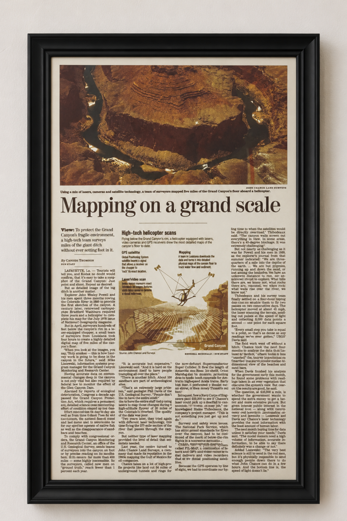
In 2002, John Chance Land Surveys, now part of FUGRO, flew a helicopter below the rim of the Grand Canyon. I was with the firm at the time, and I later served as president of its airborne and survey division.
The system was called FLI-MAP, a combination of laser scanners and video recorders guided by GPS. The Grand Canyon Monitoring and Research Center needed accurate data on sandbars and beaches to meet a federal reporting requirement. Sending surveyors on foot reached fewer than one percent of the sites each year, and many of those sites are archaeological. People walking on them is itself a problem.
The helicopter flew below the rim at roughly 45 miles per hour, collecting 8,000 data points per second. Four hours of flight produced a detailed map of five miles of canyon floor. A renowned cartographer had needed three years and a helicopter to complete comparable work for National Geographic in 1978.
The obstacles were the same ones I would face in that canyon two decades later.
GPS operates by line of sight, and the canyon walls screen out satellites. In some areas the blockage reached 45 degrees. The team settled on a four-hour window that allowed two passes on two consecutive days. The National Park Service had strict permit standards for flying above the canyon and had to be convinced of the case for below-the-rim flight in a non-rescue situation.
Convincing the Park Service. Working around degraded GPS. Finding the narrow window where the mission was possible.
I did not recognize it at the time, but the problems that project solved are the same ones I would spend the next twenty years solving.
Why was approval harder than flying?
Approval was the single greatest challenge on the project, and it was not close. The path ran through regional National Park Service leadership, then the Park Service at the national level, and finally the FAA.
I submitted the Park Service approvals and our supporting material to the regional FAA office. Roughly a month before mobilization, the answer came back. The office could not issue the approval yet. Nobody there had processed an operation of this kind in the Grand Canyon, and they were working through a backlog. They did not believe the authorization would happen in time.
That was serious, because the flight approval was holding up everything else. Park Service personnel, a biological observer from the US Fish and Wildlife Service, and helicopters to move equipment into and out of the canyon all had to fit inside a narrow operational window.
Here is what I did not do. I did not attack the regional office, and I did not go around them.
I asked a simple question instead: where can my team help?
The regional personnel suggested that FAA leadership in Washington might be able to resolve a question this new. So I asked the regional office for permission before I escalated. I got the appropriate contact, did the legwork, and organized a call that brought the regional FAA, FAA national leadership, the National Park Service, and the helibase stakeholders into the same conversation.
That call worked because everyone brought a concern and a proposed solution. Nobody in that group was an obstacle. They were people responsible for outcomes I could not see from where I sat.
Trust and communication were key. We told the FAA what we were encountering, and the FAA did the same. Together the group built an operating process every stakeholder could support.
Two safeguards came directly out of those conversations. A US Fish and Wildlife Service representative tracked California condor activity, and we were prohibited from flying in affected areas. If a condor entered our operating area, we stood down. Separately, we contacted the helibase at the start and end of every flight, and if an emergency developed we landed immediately and confirmed the aircraft was down before any helicopter deployed.
Both protocols were activated during the mission.
The approval came. Just as importantly, the relationships survived.
What happens when the shortest route is not the safest route?
Once we had permission, we had to prove the flights were survivable.
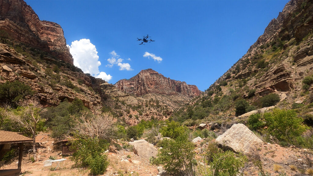
We selected NDAA compliant Skydio and Wingtra aircraft, and senior engineers from Both partners helped us evaluate the hardest routes. Then we simulated, and simulation turned out to be the most valuable preparation we did.
For the power assets, the intuitive flight path was to start near the bottom and fly straight up toward the top. In simulation, that route put the aircraft into the canyon wall. So we tried diagonal paths at roughly forty five degrees. Those collided as well.
What finally worked was a horizontal, staggered, stair step pattern. It required far more flight planning and was less direct. It also produced the terrain clearance we needed, and it held up in the field exactly as it had in simulation.
That project permanently changed my definition of efficiency. The shortest route was not the safest route, and it was not the most effective one either. Real efficiency includes safe completion, reliable data, and adequate contingency. A flight plan that saves twenty minutes and destroys an aircraft has not saved anything.
What does the canyon actually do to a field team?
The Grand Canyon is breathtakingly beautiful. The hidden reality is how dangerous it can be.
We were working during summer operations when we observed a temperature of approximately 118 degrees. We had access to Park Service radios, so we could hear emergency traffic.
That is how we heard about the two year old.
The report described a child who had overheated and was moving in and out of consciousness. We did not wait for instruction. We started to bring the drone home immediately, because a helicopter response was almost certainly about to launch.
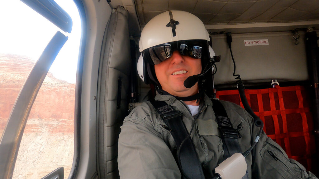
About a minute later the helibase called and instructed us to land and report when the aircraft was down. We were already flying it back. We landed quickly, notified the helibase, and the emergency helicopter deployed.
My heart sank. I am a father of four. My first reaction was to wonder how a two year old had ended up in that heat. My second, the one that stayed with me, was simply to pray the child was all right.
Later I asked the Park Service representative how often people had to be airlifted out of the canyon. He told me it could be one or two evacuations per day during peak summer months. It still amazes me how breathtakingly beautiful the Grand Canyon is, and how quickly that beauty can become dangerous.
We held a safety briefing after that. The lesson was not that our protocol worked. It was that we needed to anticipate emergency aviation movement before anyone formally instructed us to move.
The heat came for me too.
The Park Service team gave us safety knowledge we could not have generated ourselves. The ranger told us not to wear standard safety vests, because the extra layer would raise our heat risk. He told us to get into the stream and cool down if we needed to, and told us what to watch for: dizziness, muscle cramps, headaches, heavy sweating, cool or clammy skin.
I am from Louisiana. I understand humid heat. Arizona dry heat gives you different warning signs.
While walking miles with equipment, and after drinking a great deal of water, I started to feel dizzy and began cramping. I recognized it, stopped, and lay down in the stream. The relief was immediate.
Then I told the team about it. That mattered more than the incident itself. All stop authority is only real when the most senior person on site uses it out loud, and that culture has to outrank schedule, seniority, and the prestige of the project.
We paused again during a midday heat spike, and Park Service leadership gave us the latitude to extend the schedule. Those breaks improved our equipment reliability, our data quality, and our mental endurance. Pausing at the right time improved the outcome rather than threatening it.
What do you do when the aircraft lands in the wrong place?
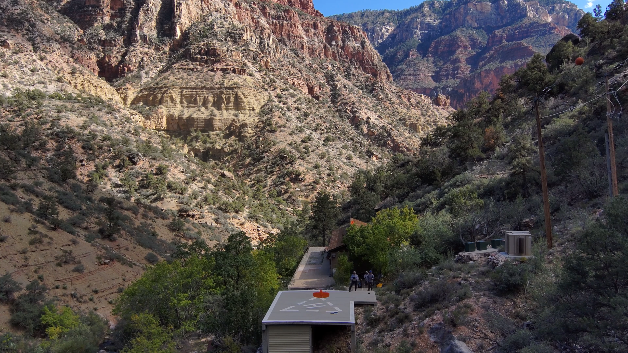
We used a helipad for VTOL launches and landings in the inner canyon. Canyon geometry creates multipath and positioning error, so we knew that GPS could not be fully trusted.
During one landing, the aircraft began descending vertically toward a point roughly twenty five feet off the helipad, over sloped and uneven ground. We caught it at about fifty feet. At the same moment, Park Service radio traffic made it difficult to talk to the pilot.
Two systems degraded at once. Neither surprised us, because we had practiced for both. If radio communication was lost, the pilot looked to the visual observer, the aircraft was paused, and the observer used predetermined hand signals to walk it over the landing area. The pilot repositioned and landed safely.
Nobody had to invent a response under pressure. That is the entire point.
A written contingency is not a contingency. A rehearsed one is. After the canyon, we started carrying dedicated radios for internal flight communication so Park Service emergency traffic could never become a single point of failure.
We used all stop authority one more time, on the North Rim.
Our original plan for inspecting power poles put the pilot close to the assets. When we reached that location, the terrain was far steeper and more dangerous than the plan suggested. I was the pilot, and I did not feel safe. A slip there meant a fall into the canyon and most likely death. I was prepared to cancel the inspection.
The Park Service drone lead and I called an all stop for the location. We evaluated alternatives against clear criteria: reliable aircraft connectivity, adequate visual line of sight, a safe launch and landing area, separation from canyon visitors, and preservation of the required data quality.
The alternative launch point was not operationally ideal. It was safer, and it still met the data standard.
A field adjustment is acceptable only when it is informed, collectively evaluated, and still meets safety and mission requirements. Improvisation is not permission to accept unmanaged risk.
The night on the helipad
Because the mission ran multiple days, we had a rare opportunity to sleep near the ranger cabin or on the helipad. We chose the helipad. With no artificial light, the sky was clearer than anything I had seen, and I have spent a great many nights outdoors in remote parts of South Louisiana.
At about four in the morning, a woman screamed. A snake had gotten close to her sleeping bag near the cabin. The ranger later told Chad that a large snake lived under that cabin, which explained why Chad had preferred the helipad. I do not like snakes, and I remain grateful for that decision.
Preparation is essential, but it should not become so consuming that the team misses the rare thing happening around it.
What did the mission actually deliver?
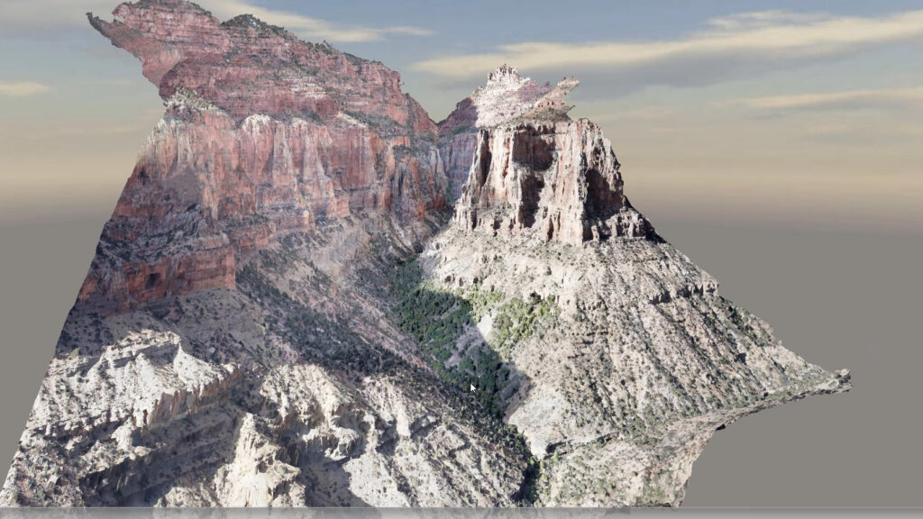
The completed dataset included a virtual fly through of the project area, a high resolution georeferenced orthomosaic, point cloud data for terrain evaluation, a digital twin of the inner canyon pump house, detailed photographs of the power assets, and 4K video.
The virtual fly through carried the bid package. Bidders and contractors could examine terrain, route, access constraints, and critical work areas without entering the canyon. That was the original safety goal, delivered.
The orthomosaic produced a second benefit nobody planned for. After a destructive fire in the canyon, that pre fire imagery became a record the Park Service and project team could review remotely and share with subject matter experts in other states.
Good geospatial data does not expire when the project closes. It becomes institutional memory.
The Calculated Risk Framework
We turned risk into calculated risk through research, simulation, and preparation. Here is how I sequence that work on any mission without a playbook.
1. Define the safety problem before you define the deliverable. We did not start with drones. We started with the number of people who had to walk into a dangerous canyon. The technology followed the problem.
2. Treat approval as a work package, not a form. Approvals had a scope, a schedule, a critical path, and dependencies. Budget approval as paperwork and you will be a month from mobilization with no authorization and a fully committed team.
3. Escalate with permission, never around people. I asked the regional office where we could help, and I asked before contacting anyone above them. Escalation should connect the right people. It should never embarrass anyone.
4. Convert every stakeholder concern into a safeguard. Condor activity became a stand down rule. Emergency helicopter operations became a mandatory land and report protocol. Both were activated during the mission. Concerns are design inputs, not obstacles.
5. Simulate until the route survives the terrain. The direct route failed. The diagonal route failed. The stair step worked. Find that out in software, not at altitude.
6. Practice the failure, not just the plan for it. We recovered a landing with degraded positioning and blocked radios because we had rehearsed hand signals in advance.
7. Make all stop real, and use it yourself. I stopped for my own heat symptoms, and I stopped for an unsafe launch point. If the senior person never stops anything, nobody below them will either.
None of these seven steps came from a manual. They came from twenty years of running into the same problems in the same canyon with different equipment.
A note on budgeting work like this
You cannot budget a mission like this by estimating flight time. Approval effort, safety analysis, simulation, contingency planning, mobilization, and data processing all carry real cost. Have that conversation with your technical team before scope and fee are committed, and then with the client before award. Cost understood early is a conversation. Cost discovered late is a conflict.
Key takeaways
- Innovation is not the aircraft. It is the approval path, the simulation, the safeguards, and the discipline behind it.
- Authorization on paper does not guarantee safe conditions in real time.
- The shortest route is rarely the safest one. Safe completion is the real definition of efficiency.
- Stakeholder concerns are design inputs. Turn each one into a safeguard.
- A contingency you have not practiced is only a document.
- All stop authority is real only when leadership uses it first.
- Local knowledge and technical expertise are different things. Complex missions need both.
- Budget the whole mission, not the flight time.
Why this mission was personal
My father was Major William Henry Femmer. He served during World War II, joined the United States Air Force around the time it became an independent service, graduated with Class 48 C which was the first pilot class of the newly formed US Air Force after WW2, and retired as a major.
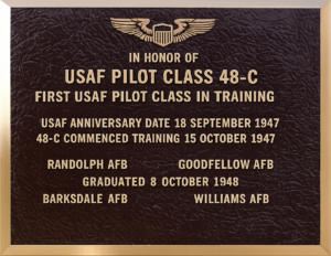
He died when I was eight. I did not get enough time to know him or hear his stories directly. What I have is what our family preserved: photographs, uniforms, flight books, handwritten notes, and the memories of people who knew him.
I do not equate what he did with what I do. Our service and our circumstances were not the same. But I believe I inherited his courage, his discipline, and his sense of duty. Those are the qualities that carried me through a mission with no playbook, where the only way forward was to be patient, earn trust, and solve one problem at a time.
I am humbled and honored to have played a small part in American aviation and drone history.
What I want my children and grandchildren to understand is that the family connection is not about being first. It is about service, courage, preparation, and using aviation to accomplish something meaningful.
I cannot recover the years I lost with my father. I can preserve his story, and leave a firsthand account of my own.
Legacy is not simply what we accomplish. It is what we preserve, share, and pass forward.
What was the first commercial drone operation below the rim of the Grand Canyon?
It was a mission supporting a Trans Canyon Waterline project, flown to capture continuous video, high resolution imagery, and geospatial data along the waterline corridor and the inner canyon pump house. The purpose was to give bidders the information they needed without requiring them to enter the canyon. According to my direct experience, no commercial operator had previously received approval for this type of operation below the rim
Why is drone approval harder than the flight itself on complex sites?
Because approval involves multiple independent authorities with different mandates. On this project the path ran through regional and national National Park Service leadership and then the FAA, with additional coordination for wildlife protection and emergency helicopter operations. Each authority has legitimate concerns that must be converted into workable safeguards before anyone flies.
Do drones actually improve safety on hazardous sites?
Yes, when they replace human exposure rather than adding to it. On this mission, a virtual fly through let bidders, contractors, and engineers study terrain and access constraints remotely instead of hiking into a canyon where evacuations were a routine summer occurrence.